A major winter storm will bring accumulating snow, and possibly ice, to the DC region Sunday.
Miri Marshall, Kaitlyn McGrath, Topper Shutt
10:52 AM EST January 19, 2026
10:57 PM EST January 21, 2026
WASHINGTON — This storm is still days away, but there is growing confidence that this will be a high-impact, significant winter storm. Here’s what we know and what still needs to be sorted out.
Summary
- This will start as snow
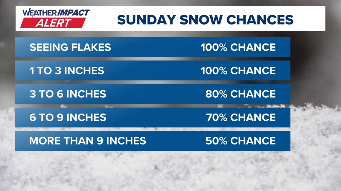
- Snow totals could be significant
- The storm will start late Saturday night and last throughout the day on Sunday
- Frigid cold follows: Saturday through the following Saturday temperatures stay in the 20s
- Track of the storm
- Strength of the storm
- Snowfall totals
- If/when the storm mixes with ice
Why the snow could happen
We are still on track for a major winter storm across the DC region this weekend. The biggest changes that we are seeing is the possibility for a wintry mix to accompany the snow.
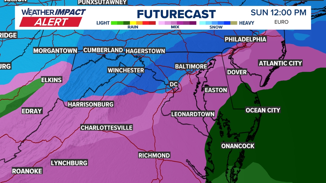
The European model still calls for highly impactful snow amounts. One notable change is that the storm is now trending a more northerly track which could introduce ice into the equation Sunday afternoon/evening. This switch to ice would be after significant snow accumulation. The silver lining about the ice trend, is that the temperature profile favors sleet over freezing rain. This would be good before sleet doesn’t pose the power outage threat that freezing rain does. Sleet would make the clean up much harder and weigh down the light, fluffy snow that falls first.
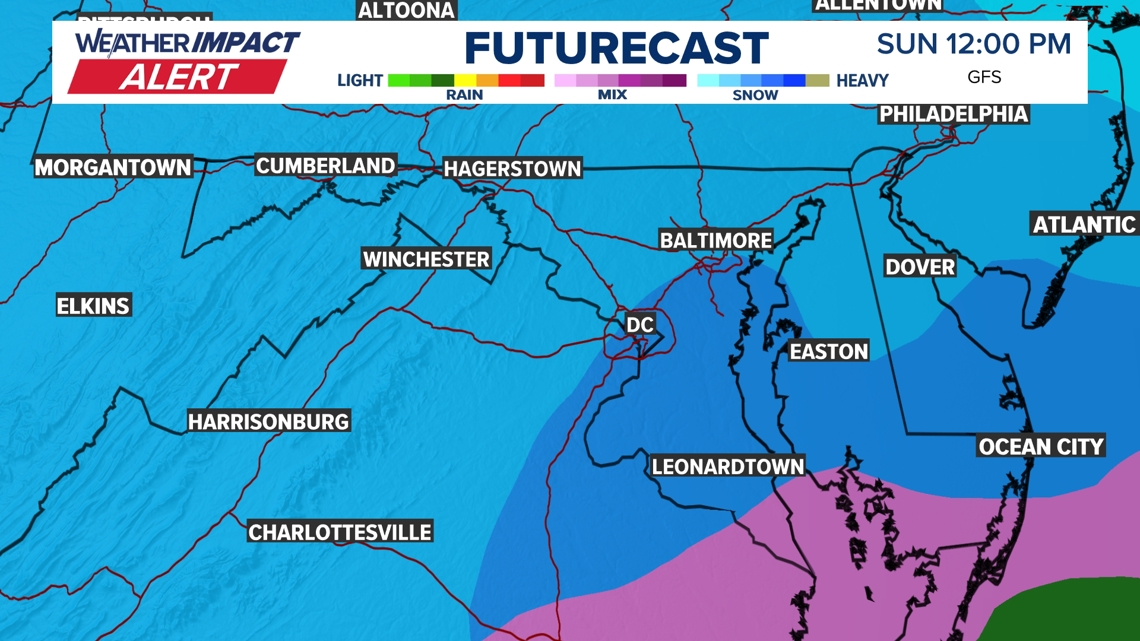
The GFS, American model, still has the storm passing to our south with mostly slow. It keeps the rain/snow line and wintry mix toward Southern Maryland and Richmond. This solution would bring measurable snow to the region, with slightly higher amounts south before the flip in our southern most areas. This model has been wobbling back and forth with some runs showing only a glancing blow. It’s typical and we are monitoring it.
Plan on disrupted travel for days and school/business impacts for the start of next week.

EURO (SNOW TO START, THEN WINTRY MIX)


Published Date : 2026-01-22 03:57:00
Source : www.wusa9.com
")
")