Tracking light snow or flurries late Tuesday night.
Topper Shutt, Kaitlyn McGrath, Miri Marshall
5:25 AM EST February 2, 2026
6:28 PM EST February 2, 2026
WASHINGTON — Three Things to Know:
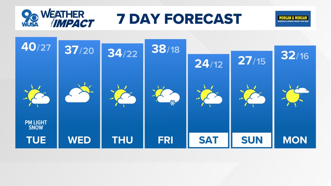
- Not as frigid this week
- Light snow/flurries late Tuesday night
- More flurries/snow showers possible Friday
Forecast:
Tonight: Clear and cold. Lows: 10 – 20. Winds: WSW 10.
Tuesday: Partly cloudy, cold with p.m. clouds. Flurries and light snow late. Highs: 35 – 40. Winds: SW 10.
Tuesday Night: Mostly cloudy and cold. Flurries and light snow. Lows: 20s. Winds: N 10.
Wednesday: Partly cloudy and cold. Highs: 34 – 39. Winds: NW 10.
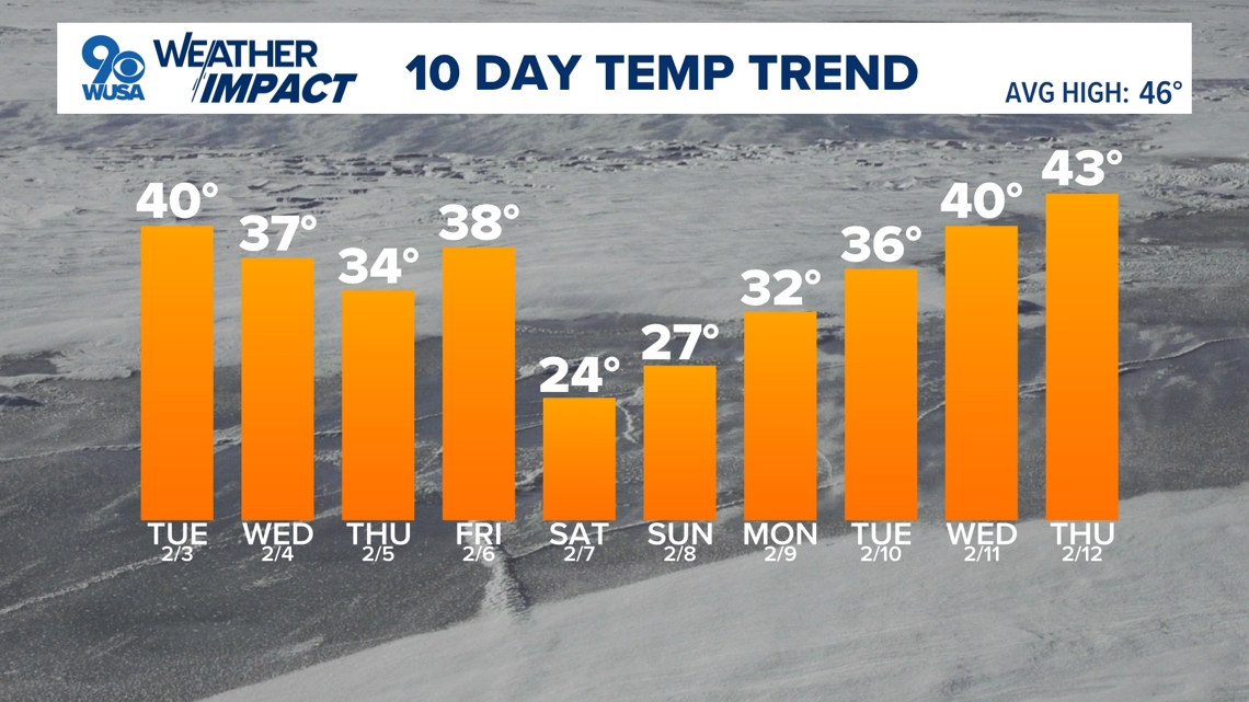
We finally climbed above freezing for the first time in 10 days! The high temperature in DC hit 34 Monday afternoon – and we have more above-freezing days on the way. This week will be milder than last week (though still below average) with nice sunshine on most days. It will be another week with daytime snow-melt and nighttime re-freezing, so be on the lookout for black ice!
We’re tracking our next chance for snow late Tuesday night into Wednesday morning. A wave of low pressure looks to pass just south of the region, bringing a quick period of flakes or light snow from 9 p.m. – 5 a.m. Wednesday. This will not be a major winter storm, but we could pick up a dusting to an inch.
The rest of the week will feature cold mornings and chilly afternoons in the mid to upper 30s. Another round of light snow looks to move through the region Friday. This could bring another coating to an inch or so of snow.
Behind that next chance, temperatures turn bitter cold again for the weekend with low temperatures in the single digits and high temperatures in the low 20s.


Published Date : 2026-02-02 23:28:00
Source : www.wusa9.com
")
")