Clear skies continue through the weekend, leaving us cool Sunday morning, but highs return to the 60s in the afternoon.
Topper Shutt, Kaitlyn McGrath, Miri Marshall, Grace Thornton
8:28 AM EDT March 28, 2026
11:41 PM EDT March 28, 2026
WASHINGTON — Three Things to Know:
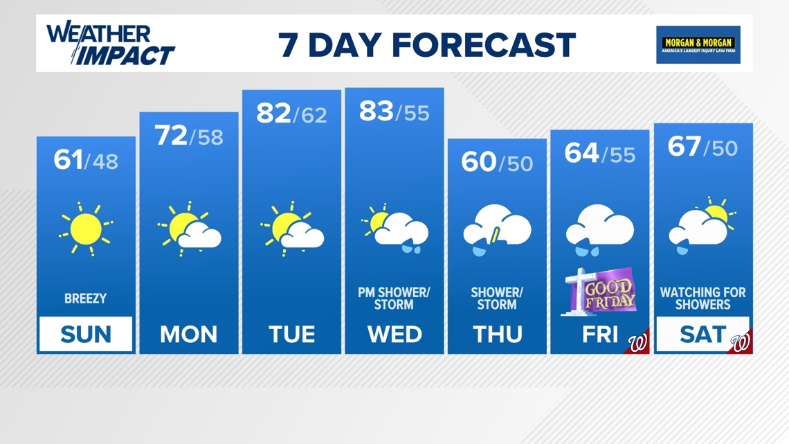
- Cold Sunday morning
- Warming trend Sunday afternoon
- Warmth sticks around for the beginning of the work week
Forecast:
Sunday: Mostly sunny, breezy and seasonable. Highs: 57 – 63. Winds: S 5 – 15.
Sunday Night: Partly cloudy. Lows 40s & 50s. Winds: S 10
Monday: AM spot shower, clouds. Highs 70s. Winds SW 10.
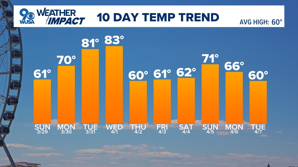
Sunday mornings early risers will need a coat again, with temperatures in the 30s before the afternoon warm up. Sunday will stay on the breezy side with S winds gusting to 25 mph. Mostly sunny, highs in the 60s.
Monday starts slightly cool but more comfortable, with out-the-door temperatures in the mid to upper 40s. Southerly winds continue Monday, warming the region by another 10 degrees or so. Highs reach the 70s. Expect additional warming Tuesday and Wednesday. High in the lower 80s.
The gradual warming will eventually bring rain chances to the DMV next week. Showers, rain, and isolated storm chances begin Wednesday evening, with a few rounds of wet weather continuing through Thursday and Friday. Afternoon temperatures dip into the 60s.
There is low confidence as to how long the rain chances will last, but right now, it looks like skies will brighten up and dry out throughout Saturday and Easter Sunday. The timeline and confidence will change as we move closer to next weekend. No need to cancel any Easter weekend plans right now. Check back on the forecast throughout next week.

Published Date : 2026-03-29 03:41:00
Source : www.wusa9.com
")
")