Plan on rain and showers late Saturday and Saturday night.
Topper Shutt, Kaitlyn McGrath, Miri Marshall, Grace Thornton
4:52 AM EDT April 24, 2026
11:27 PM EDT April 24, 2026
WASHINGTON — Three Things to Know:
- Cloudy but dry Saturday until 4 or 5 p.m.
- Rain and showers moderate 6 p.m. – 9 p.m. Saturday
- Cloudy, breezy and chilly Sunday
Forecast:
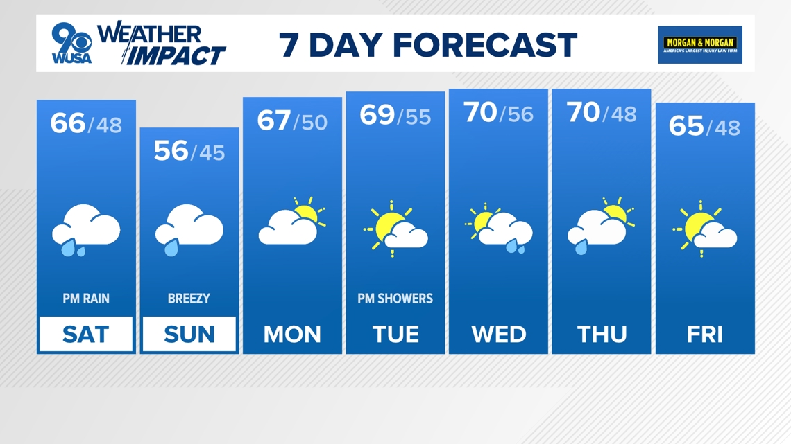
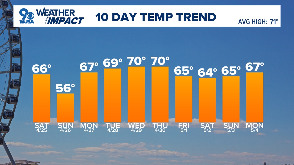
Saturday: Mostly cloudy and cooler with rain and showers late. Highs: 62 – 67. Winds: E 10.
Saturday Night: Mostly cloudy, breezy and chilly. Rain and showers. Lows: 45 – 50. Winds: NE 10 – 15.
Sunday: Mostly cloudy, breezy and chilly, early shower possible. Highs: 54 – 59. Winds: NE 10 – 15 +.
The end of the work week is here, with some wetter changes to the forecast. But have no fear, there will still be plenty of dry time to get out doors this weekend too. By Saturday, everyone gets a good soaking in – but not until the evening and at night. We have issued a Weather Impact Alert from 6 p.m. Saturday until 6 a.m. Sunday.
Most of Saturday will be dry, just mainly cloudy and cooler in the mid-60s, before showers and rain develop at night. We could see wet weather as early as 4 p.m. in our western most areas with rain overspread the metro areas by 7 p.m. Steady rain will continue throughout Saturday night with some showers lingering Sunday morning.
After a bit of a damp start, Sunday stays cloudy with afternoon temperatures quite chilly in the mid 50s with a steady breeze. More sunshine and a slight warm up moves in for Monday – though temperatures will be below average.
Shower chances return Tuesday night ahead of more rain Wednesday into Thursday. As we head into May, temperatures look to remain below average.

Published Date : 2026-04-25 03:27:00
Source : www.wusa9.com
")
")