Thursday marks the 12th straight day without precipitation in and around DC. We could add another week to the tally.
It’s not totally unexpected this time of year, given that we’re in the second half of fall’s nice day season — loosely defined as dry weather with highs between 65 and 85. The 11 days before Thursday all had highs between 62 and 72.
Still, we’re now certain to finish October with below-average precipitation, following two wetter-than-normal months. In DC, nine of the last 12 months have been drier than normal.
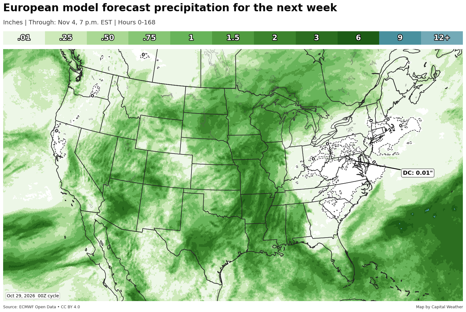
The next legitimate rain chance now appears to be next Thursday. We initially had some hope for rain Sunday or Monday, but that has largely evaporated. While a passing shower or two isn’t impossible, the odds of breaking the dry streak across much of the region are low.
And while rain chances late next week look decent for now, the setup is similar to the one this coming weekend that has largely dried up. In the near term, low-pressure systems will tend to pass to our northwest, swinging cold fronts through the region. This time of year, moisture tends to be limited with these frontal passages.
Drought concerns are limited but not vanquished.
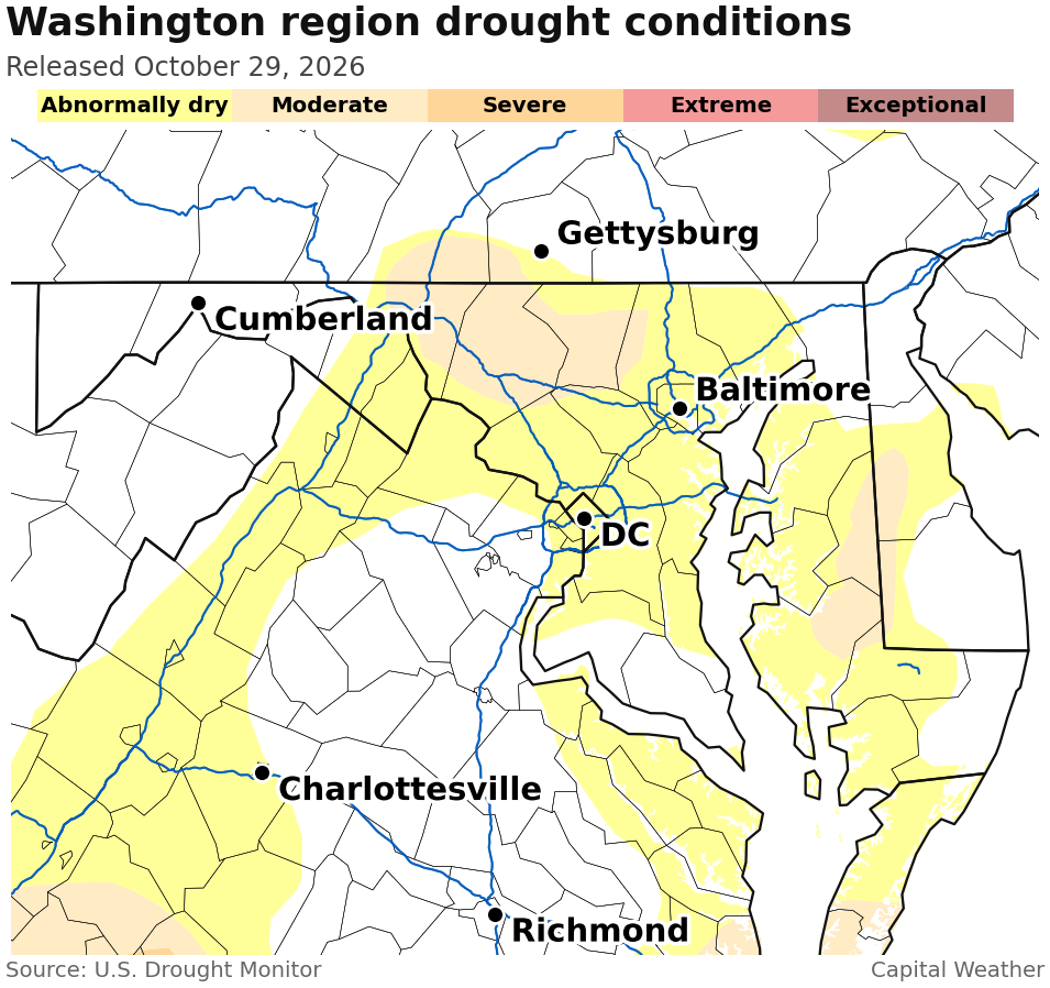
Far northern Montgomery County remains in moderate drought, according to the U.S. Drought Monitor, as do areas of Maryland farther north. Much of the rest of the region, including DC, is rated abnormally dry. Drought hasn’t expanded recently — these conditions are lingering from earlier in the year. Should the dry weather persist, we could see drought expand again.
DC is running about 7 inches below average for the year, while Baltimore is around 5 inches drier than normal. Not everyone is in the same boat, though — Dulles Airport is a tick above average for the year.
Published Date : 2026-10-29 17:30:00
Source : www.capitalweather.com