Topper Shutt, Kaitlyn McGrath, Miri Marshall
3:38 AM EST March 6, 2026
11:37 PM EST March 7, 2026
WASHINGTON — Three Things to Know:
- Early a.m. shower possible, clearing late Sunday and still warm
- 70s and even an 80 degree day next week
- Strong cold front moves through Thursday
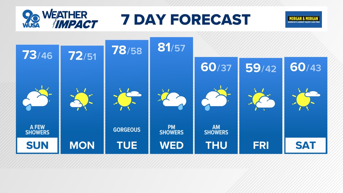
Forecast:
Sunday: Mainly a.m. showers then partly sunny late and warm. Highs: 69 – 74. Winds: SW/NW 10.
Sunday Night: Clear and colder. Lows: 40s. Winds: NW 10.
Monday: Mostly sunny and warm. Highs: 68 – 73. Winds: NW/S 10.
Don’t forget we “spring forward” with the start of daylight saving time this weekend. We’ll lose the hour of sleep between 2 a.m. and 3 a.m. Sunday. With this change, the sun won’t rise until 7:30 a.m. but it also won’t set until 7:08 p.m. So, move your clocks ahead one hour before you go to bed tonight. Some showers are possible late tonight but we have a better chance Sunday morning as a cold front moves through the Metro Area.
Sunday will start off with some clouds and some showers before we see more sunshine in the afternoon. We remain warm behind the front with highs in the upper 60s to low 70s.
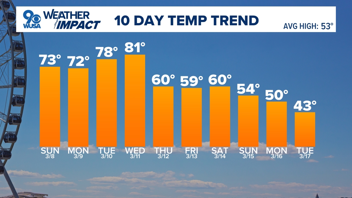
Next week looks even warmer with a nice stretch of 70s Monday and Tuesday, and even 80s potentially on Wednesday. We’ll also see more sunshine, especially earlier in the week before rain chances return Thursday with a strong cold front.
Don’t get too used to the warm temperatures! Cooler weather looks to return for the second half of March.


Published Date : 2026-03-08 04:37:00
Source : www.wusa9.com
")
")