Dress in layers on Monday as wind chills plummet into the 20s.
Topper Shutt, Kaitlyn McGrath, Miri Marshall
4:21 AM EST December 5, 2025
9:50 PM EST December 7, 2025
WASHINGTON — Three Things to Know:
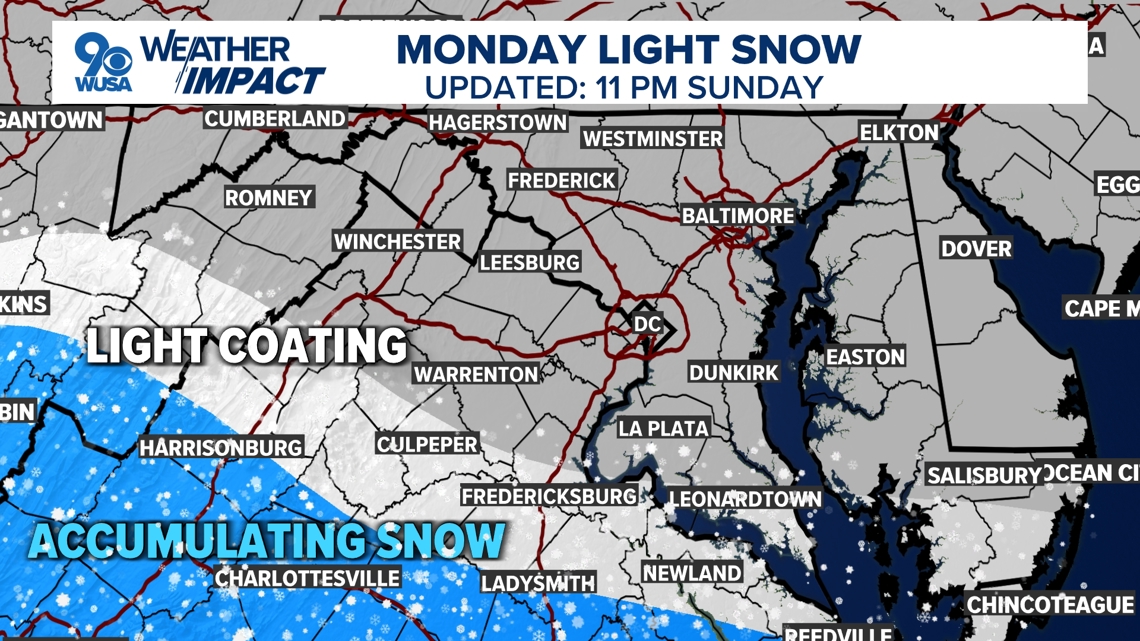
- Period of light snow/flurries south of DC Monday
- Breezy and very cold on Monday
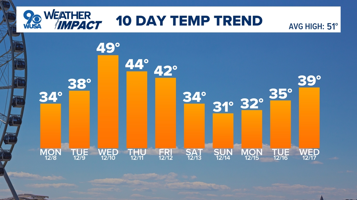
- Temperatures stay below average through the entire week
Forecast:
Sunday Night: Increasing clouds and cold. Lows: 27-33. Winds: N 5-10.
Monday: Cloudy, cold, and breezy. Light snow/flurries south. Highs: 30-35. Winds: NE 10-20.
Monday Night: Clearing skies and very cold. Lows: 15-20. Winds: NE 5.
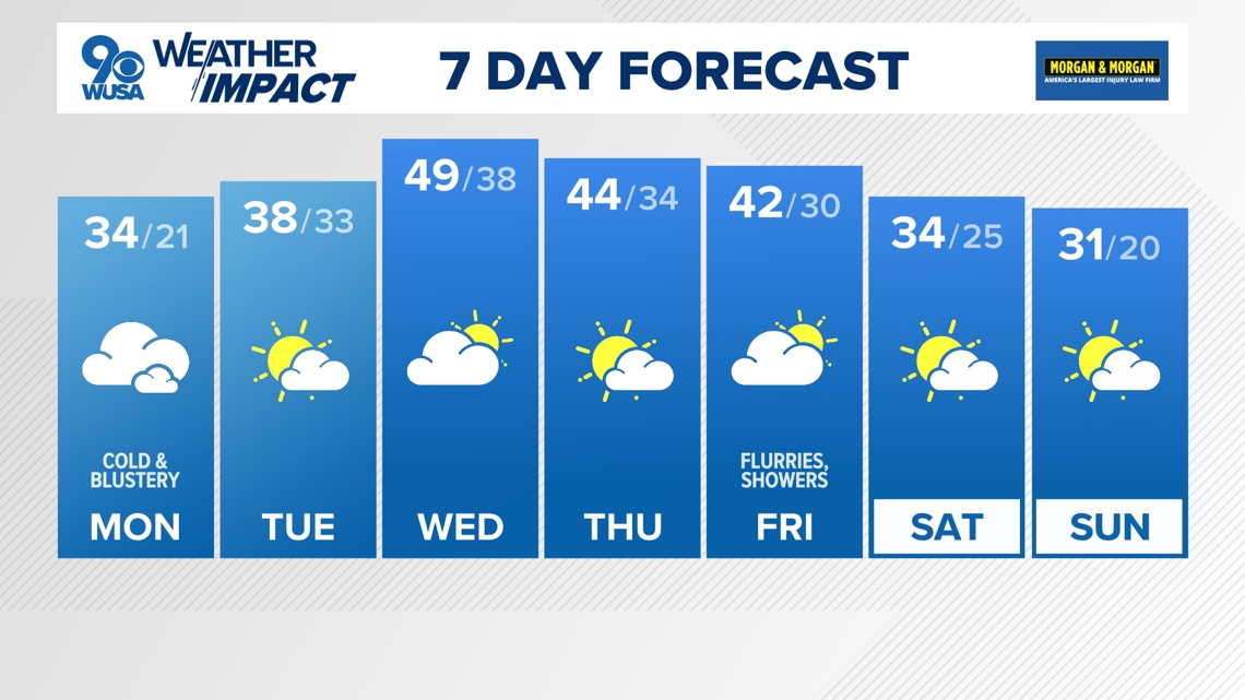
Very cold air moves in on Monday with high temperatures only in the low 30s. However, gusty winds will make it feel more like the 20s, so be sure to bundle up. Temperatures will stay below average for the entire week.
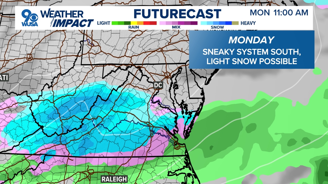
As the cold air moves in on Monday, an area of low pressure will pass by to our south bringing with it a period of light snow or flurries just south of DC Monday morning through perhaps early afternoon. A light coating can’t be ruled out for areas such as Fredericksburg, Orange, and Culpeper. However, heavier precipitation could bring some accumulation (an inch or two) to areas like Staunton and Harrisonburg, but the DC Metro should stay dry. If you’re traveling even farther south to perhaps Richmond, several inches of snow will be possible. Be safe if traveling south.


The rest of the week will remain chilly and mostly dry with just a couple of chances for light precipitation. There could be a few rain showers sliding in for Wednesday night but the system does look to be heading further to the north. And for the end of the week, we could have another round of wet weather headed our way. It’s too early to make the call on whether it will be rain or snow, but that rain-snow line will be in play.


Published Date : 2025-12-08 02:50:00
Source : www.wusa9.com
")
")