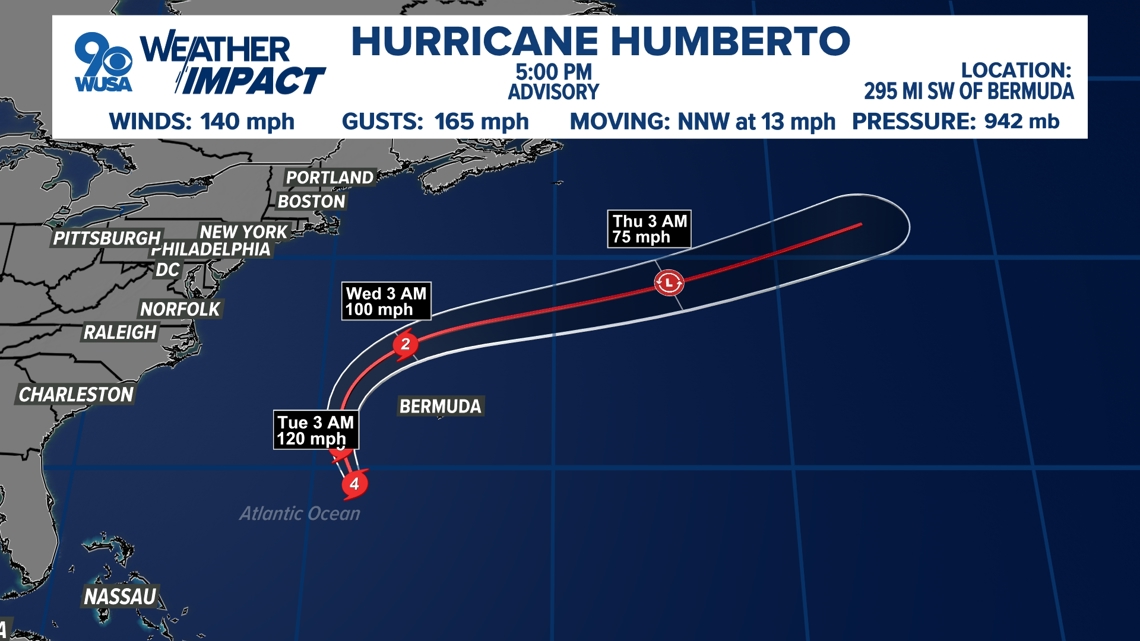
The offshore storm will bring rain to parts of Georgia, the Carolinas and Florida along with rip currents as it teams up with far-away, strong Hurricane Humberto
WASHINGTON — Key Points:
-
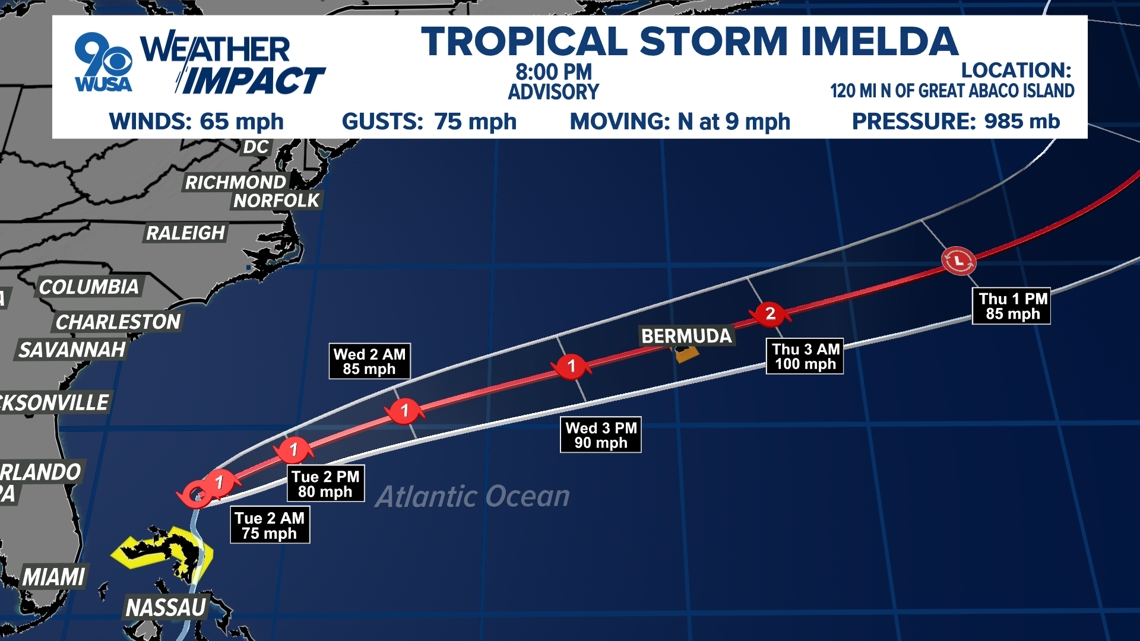
Tropical Storm Imelda developed over the weekend and is expected to become a Category 1 hurricane by Tuesday afternoon.
-
Latest computer model updates show the storm will not make a U.S. landfall but pass over the Bahamas before making a right turn out to sea. The track may poses some danger for Bermuda.
-
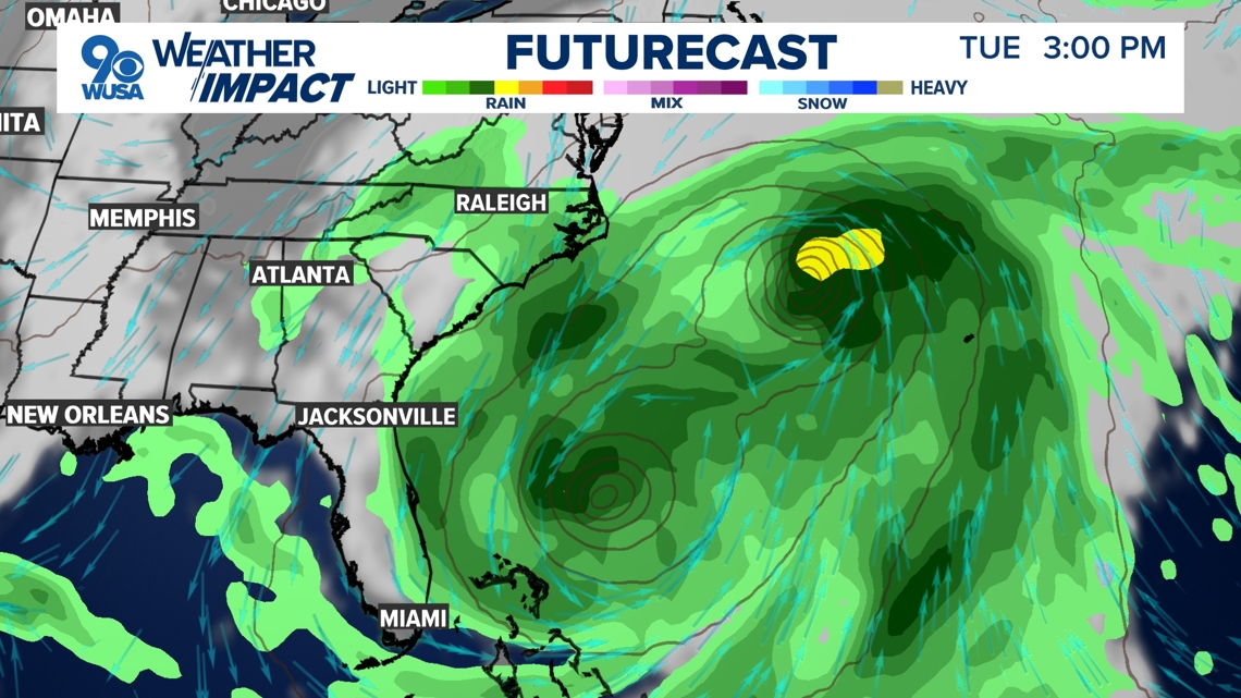
The D.C. area won’t see much impact from this system with the expected track. There is a slight chance for a shower, mainly south and west of the District early Tuesday with clouds lingering all day Tuesday.
Tropical Storm Imelda is still forecast to make a sharp turn out to sea. The storm will not make a United States landfall. Even without a landfall nor direct hit, the storm will be close enough to land bring rain and some breezes. It will then strengthen into a hurricane and accelerate east away from the East Coast, passing nearby Bermuda.
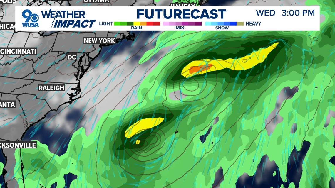
With this track, the D.C. area can expect minimal impacts. The region will stay cloudy, but mainly dry. A few showers associated with the system could spread especially into Southern Maryland and southern and western Virginia Tuesday morning.
In conjunction with Hurricane Humberto, high seas, rip currents, and beach erosion along the beaches of East Coast, including those of the Delmarva, are all likely through the middle of the week.


Published Date : 2025-09-30 02:30:00
Source : www.wusa9.com
")
")