A coastal storm kicks up strong winds over the weekend and keeps wind chills below zero.
Topper Shutt, Kaitlyn McGrath, Miri Marshall
5:25 AM EST January 30, 2026
10:10 PM EST January 30, 2026
WASHINGTON — Three Things to Know:
- Dangerously cold through Monday morning
- Gusty winds Sunday into Monday
- Tracking snow chances Wednesday p.m. through Thursday
Forecast:
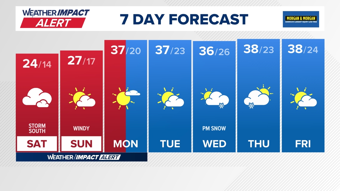
Saturday: Mostly cloudy and very cold. Flurries and light snow possible south and east. Highs: 19 – 24. Winds: N 10 – 20.
Saturday Night: Mostly cloudy, breezy and cold. Flurries south and east. Lows: 8 – 18. Winds: NNW 15 – 25.
Sunday: Partly cloudy, windy and very cold. Highs: 23 – 28. Winds: NW 15 – 25.
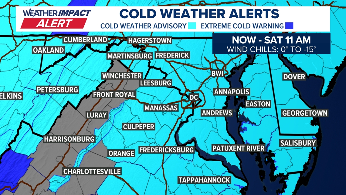
We are in the middle of a Weather Impact Alert through Monday morning for dangerously cold temperatures.
Another Cold Weather Advisory is in effect now through 11 a.m. Saturday morning. This is for wind chill values between zero degrees and 15 degrees below zero. You will definitely need to bundle up for Friday night plans!
The arctic air stays locked in place over the weekend as a strong storm develops off the coast. The storm will stay too far east to bring any significant impact to the DC region, but we may still see light flurries for DC and areas along the I-95 corridor (coating to 1/2 inch south). Best chance for snow is around southern Maryland and Ocean City. What you’ll notice more than snow is the wind! Really blustery wind will kick up Sunday and persist into Monday morning. With the strong wind, Sunday will end up “feeling” like our coldest day of this entire arctic stretch.
By Monday morning, temperatures will still feel sub-zero, but by the afternoon we are set to climb above freezing for the first time in 10 days! Next week will be milder (though still below average) with nice sunshine. It will be another week with daytime snow-melt and nighttime re-freezing, so be on the lookout for black ice!
We’re track our next chance for snow Wednesday night into Thursday morning. A wave of low pressure looks to pass through the region after the evening commute Wednesday and bring a period of light to moderate snow through Thursday mid-day. If the current track and strength of the system holds, this would bring several inches of snow to the region. It is too soon for an exact snowfall prediction, but rest assured this would not be a major winter storm. We will provide updates over the next several days with the expected impacts.


Published Date : 2026-01-31 03:10:00
Source : www.wusa9.com
")
")