A few showers develop late Thursday night.
Topper Shutt, Kaitlyn McGrath, Miri Marshall, Grace Thornton
5:02 AM EDT April 15, 2026
10:51 PM EDT April 15, 2026
WASHINGTON — Three Things to Know:
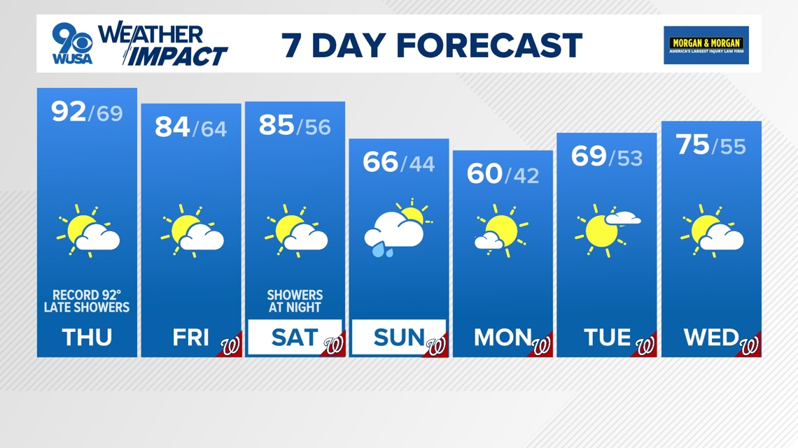
- 90s again Thursday
- Unseasonably warm Friday & Saturday
- Tracking Sunday morning showers
Forecast:
Thursday: Partly cloudy, breezy and still hot. Highs 88 – 93. Winds: SW 10 – 15.
Thursday Night: Partly cloudy and mild. Some showers and storms, mainly north and west. Lows: 60 – 70. Winds: NW 10 – 15.
Friday: Partly cloudy, breezy and warm but not hot. Highs: 80 – 85. Winds: WNW 10 – 15.
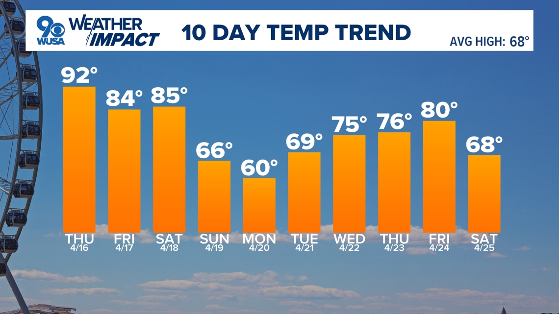
Our taste of summer continues! Wednesday was our first 90° day of the year and the first time we’ve hit 90° in April since 2017. The average first 90° day of the year is May 16th.
Wednesday Records:
Washington, DC – New Record: 90° Old Record: 89° (1941)
Dulles, VA – New Record: 91° Old Record: 87° (1967)
Baltimore, MD – New Record: 91° Old Record: 88° (1941)
Thursday Records:
Washington, DC – Record: 92° (2002) Forecast: 92°
Dulles, VA – Record: 91° (2002) Forecast: 92°
Baltimore, MD – Record: 90° (2002) Forecast: 91°
Thursday will be another mostly sunny day before showers and a few thunderstorms develop at night. Rain chances will move in from west to east between 8 p.m. – midnight. The showers and rumbles of thunder are moving in ahead of a trough of low pressure that will bring in slightly cooler (though still WELL above average) temperatures for Friday.
Friday will still be a very summer-like day with high temperatures in the mid to low 80s. The nice, warm weather will persist through much of the day Saturday before rain and showers develop later at night. A strong cold front moves through the Metro Sunday morning with some early showers but we’ll be able to salvage a nice afternoon.
Temperatures will take a temporary dip early next week in the low 60s before temperatures warm right back up.

Published Date : 2026-04-16 02:51:00
Source : www.wusa9.com
")
")