So far, the remnants of Hurricane Isaias have produced abundant rainfall in the DC area, with amounts ranging from 0.5 to 1.5 inches through 10 a.m. Sunday. The storm’s second act could bring a few severe thunderstorms late Sunday afternoon and evening, especially in the southern half of the region. One or more brief tornadoes somewhere in the area cannot be ruled out.
After the windswept rain eases between late morning and early afternoon, expect a break in the steady rain, with just spotty showers through late afternoon. It will remain breezy, with easterly gusts of 20 to 30 mph.
The main window for thunderstorms, if they develop, will be from about 5 to 11 p.m. The biggest limiting factor will be a lack of atmospheric instability because of cloudy skies and cooler air wedged into the region. But where skies brighten this afternoon and warm, humid air pushes northward, the atmosphere could become unstable enough to support a few stronger storms.
As an area of low pressure associated with Isaias’s remnants approaches, wind shear — or changing winds with altitude — will increase. This could cause some thunderstorms to rotate and potentially spawn tornadoes.
“Right now, it appears the most favorable area is going to be east of the Blue Ridge and south of Route 50,” the National Weather Service writes.
The Weather Service has placed the area under a Level 1 out of 5 risk for severe storms, with the highest tornado probabilities in Southern Maryland and Virginia’s Northern Neck.
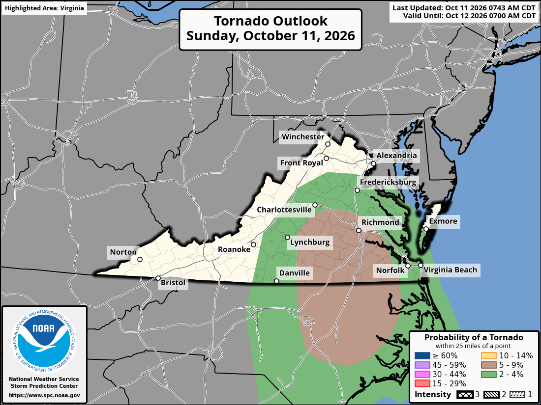
Thunderstorms may not develop at all if insufficient warm, unstable air moves into the region.
After the severe storm threat passes, showers could linger into the predawn hours Monday but should be gone by daybreak.
Additional rainfall of 0.5 to 1 inch is possible, bringing storm totals to 1 to 2.5 inches. The highest totals are expected west of the Beltway and toward the mountains, where the most rain has fallen so far.
Published Date : 2026-10-11 14:03:00
Source : www.capitalweather.com