The humidity is back, and so are storm chances. Unfortunately, the storms and their canopy of clouds could interfere with the best lunar eclipse we’ll have a chance to see until June 26, 2029.
The National Weather Service Storm Prediction Center has placed the area in a Level 2 out of 5 risk for severe storms.
Scattered storms could begin developing as soon as late afternoon but are most likely between 5 and 10 p.m.
In addition to heavy rain and lightning, damaging wind gusts are the main hazard of concern. Storms may be most numerous north of the Beltway, where isolated instances of hail and perhaps a brief tornado are also possible.
The storms won’t be particularly fast-moving, so a few pockets of flash flooding are possible, particularly in areas where multiple storms pass over the same locations. Northeast Maryland has the highest likelihood of localized flooding issues.
Questions remain about how widespread the storms will become because there isn’t a particularly strong trigger to set them off.
Eclipse cloud forecast
Computer model projections suggest most of the storms should be dissipating or moving away after 10 p.m., just as the lunar eclipse is getting underway. The eclipse peaks around midnight, when about 95 percent of the Moon will be in Earth’s shadow.
Unfortunately, even as the storms disperse, their clouds may linger. Most models project mostly cloudy to overcast skies, but some leave open the possibility of partial clearing after 10 p.m., offering potential gaps through which to view the eclipse.
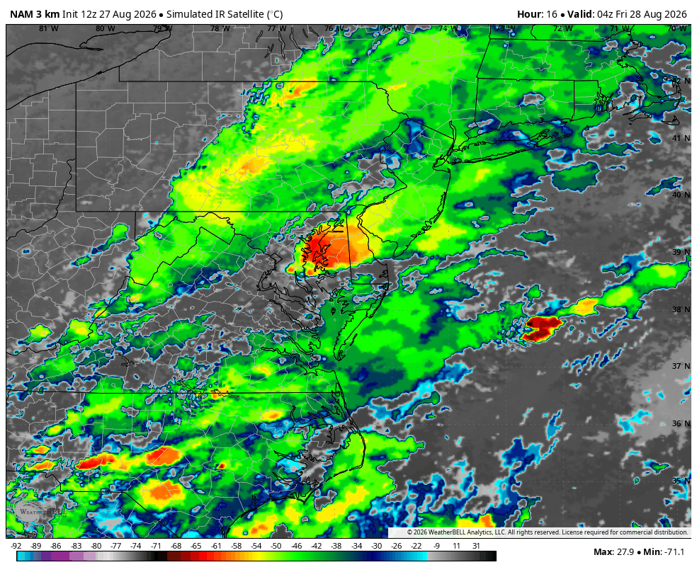
It’s unlikely that skies will remain completely overcast throughout the entire eclipse. Patient skywatchers may be rewarded with at least occasional views. Remember to share any cool photos you capture.
Jeff Halverson contributed to this report.
Published Date : 2026-08-27 15:45:00
Source : www.capitalweather.com